Potholes and highways issues
Last updated March 2024
Highways maintenance is delivered by East Sussex County Council who in May 2023 entered into a 7 year partnership with Balfour Beatty Living Places. They are responsible for all aspects of highways maintenance including road repairs, potholes, drainage, verge cutting and street lighting.
The Parish Council holds regular meetings with representatives from the Highways Department at which current local problems are flagged up. If you would like to alert the Parish Council to a particular issue, email cllr.judy.petty@brightling-pc.gov.uk However, East Sussex Highways welcome reports directly from residents who may have concerns regarding potholes, drainage, overgrown vegetation, or other issues which affect the public highway. The most effective way to report matters is via their website at https://live.eastsussexhighways.com/report-problem which will allow you to identify the location of the issue on their interactive map. You will receive a unique reference number for your report, which will then be sent directly to the local Highway Steward who will carry out an inspection.
Once the inspection has taken place, you will receive an update from the system of the Steward’s findings. You will be given the option to register an account, to monitor all reports you have made, but this is not required to receive updates on individual reports.
Alternatively, you can report matters anonymously; however, they will be unable to provide you with any updates on your enquiry in this case.
Should you wish to speak to a Customer Service Advisors directly, you can also call on 0345 60 80 193.
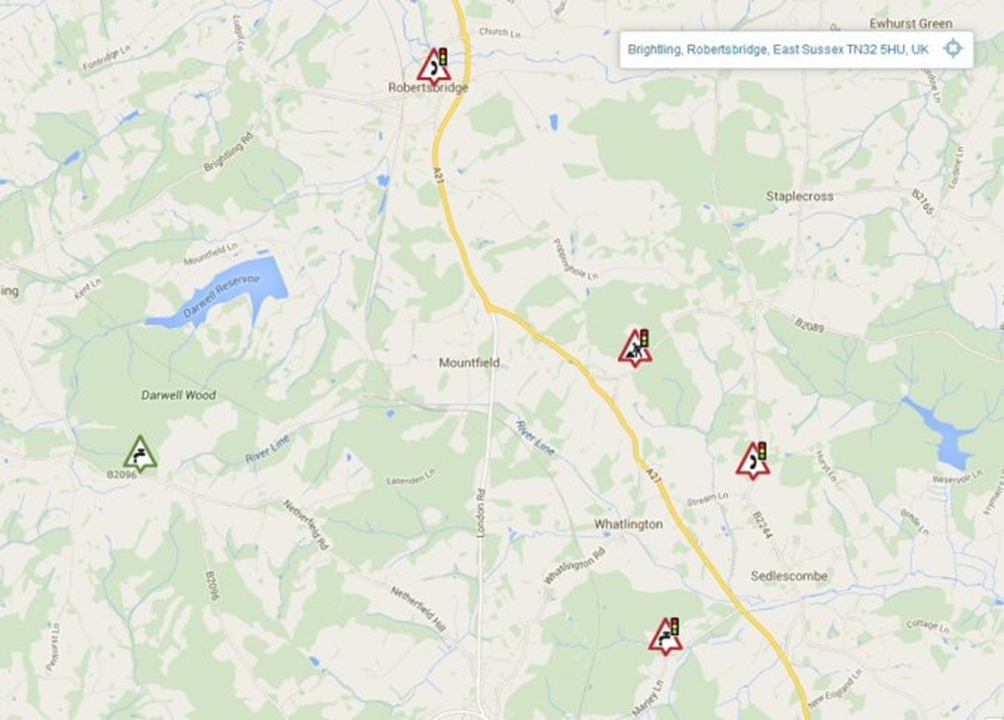
Roadworks are managed as part of a national scheme. Information can be found by logging on to https://one.network/public From this website you can find all the forthcoming roadworks. The website is very well organised and it really does have the latest data, but it takes a tiny bit of effort to get the best out of it, so here are a few instructions.
At the one.network website enter a nearby postcode (doesn’t have to be exact). That should take you to a map, which you can zoom out to see a wider local area, as in the picture.
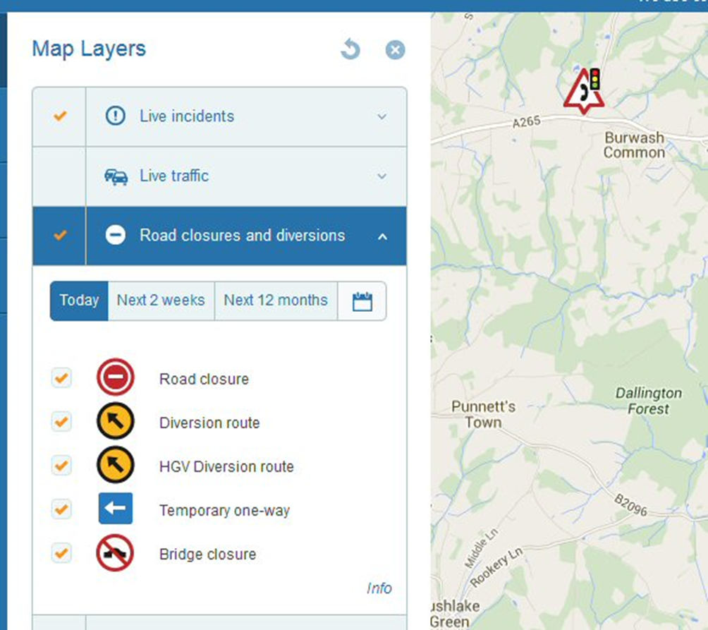
When you first go into the one.network website it shows results with a date filter. You can either click on today’s date or select next two weeks, next three months or next twelve months. By clicking on the menu you can find information relating to different map layers and headings such as ‘Road closures and diversions’ and ‘live incidents’
This only scratches the surface of what you can do. For example you can sign up for email alerts.
Fly tipping is managed by Rother District Council. Click here to report any incidents.
Finally, the characteristic wooden black and white signposts you see at most road junctions in the rural areas are known as finger posts. Sadly, current health and safety legislation deems them to be unsafe because they are not made of “passively safe” materials, i.e. oak! So, East Sussex Highways are unable to install any new ones. However, they are able to maintain the current stock and now share the cost of maintenance, including complete renewal, with your Parish Council on a 50/50 basis.
It is in all our interests, therefore, to look after them to keep the cost of repairs and renewals to a minimum. The Parish Council has compiled a map showing where our fingerposts are and giving each one a number. Road names as we know them have been added and East Sussex Highways own system of road numbering is there too. Click below to download or see the map.